


The first steps toward a scientific understanding of the Earth
🔴 Without these maps, modern geography would not exist!
🔴 Visitors to the Islamic Civilization Center in Uzbekistan can explore the great geographical discoveries of al-Ma’mun, Kashgari, and Idrisi.
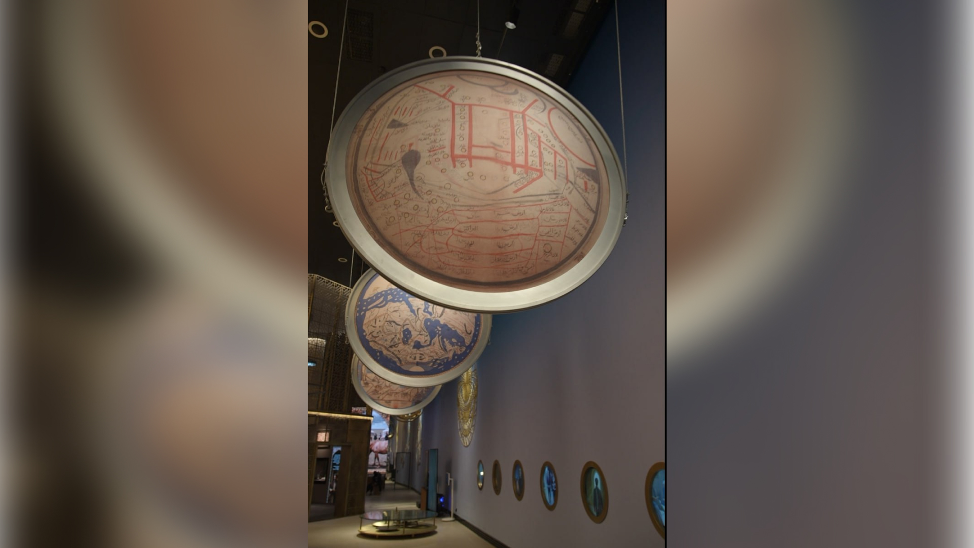
One of the most significant stages that elevated the development of science in world civilization was the Islamic Renaissance. During this era, geography, astronomy, geodesy, and mathematics reached remarkable heights, and human understanding of the world became scientifically grounded. The scientific maps created by Muslim scholars opened a completely new chapter in the history of world cartography and became the foundation of today’s global geographic knowledge system. Among the most brilliant examples of this immense scientific heritage are the World Map of al-Ma’mun, Mahmud al-Kashgari’s Map of Turkic Tribes, and al-Idrisi’s World Map depicting the western regions. These maps are exhibited in the First Renaissance Gallery of the Islamic Civilization Center in Uzbekistan.
Al-Ma’mun’s World Map (9th century)
Under the order of the great Abbasid Caliph al-Ma’mun, the Bayt al-Hikma (“House of Wisdom”) was established in Baghdad as a leading scientific center of the Muslim world. In this intellectual environment, under the leadership of Muhammad ibn Musa al-Khwarizmi and with the participation of more than 70 scholars, one of the first scientific geographical maps in human history — al-Ma’mun’s World Map — was created.
“The map was drawn based on extensive geodetic and astronomical research. The length of one degree of the Earth’s meridian was re-measured, and the exact coordinates of cities and regions were studied. It depicted the Indian Ocean as an open sea and presented the world as an island, oriented southward according to the cartographic tradition of that time. Al-Khwarizmi’s work Ṣūrat al-Arḍ (‘The Shape of the Earth’) provided the scientific foundation for this map, introducing into world cartography the concepts of coordinate systems, climatic division, and precise geodetic measurements,” explains Dr. Fakhriddin Ibragimov, Doctor of Philosophy in History.
Mahmud al-Kashgari’s Map of Turkic Tribes
In the 11th century, Mahmud al-Kashgari’s Dīwān Lughāt al-Turk (“Compendium of the Languages of the Turks”) was created — not only an encyclopedic linguistic masterpiece but also a unique source reflecting the ethnic, cultural, and geographical landscape of Turkic peoples. In his work, al-Kashgari illustrated the locations of various Turkic tribes across different regions of the known world, presenting a complete picture of their political and cultural geography. The map includes several tribes: the Oghuz, who lived between the Altai Mountains and the western regions and later founded the Seljuk Empire; the Kipchaks, who ruled territories stretching from the Kazakh steppes to the Caspian Sea and were famed for their horsemanship; the Khazars, who lived around the Caspian region as a powerful semi-nomadic people; the Uyghurs, spread from Altai to Mongolia and China; and the Karluks, located between the Oghuz and the Uyghurs, who played a key role in the early rise of the Ghaznavid Empire.
Muhammad al-Idrisi’s World Map
In the 12th century, al-Idrisi, who lived and worked at the court of Roger II, King of Sicily, created one of the greatest masterpieces in world cartography. In 1154, he produced a world map engraved on a thin silver plate accompanied by his famous work The Book of Roger (Kitāb Rujār). This map covered Europe, Africa, and Asia, introducing the first global system of geographic classification. Al-Idrisi divided the world into 70 regions and marked about 2,500 place names on the map, while his text described over 6,000 geographic locations. His use of a grid-based coordinate system and precise delineation of continents and seas had a profound influence on the rise of geography and navigation in Europe in subsequent centuries. Historical sources note that explorers such as Columbus and Vasco da Gama relied on Idrisi’s data.
The maps created by Muslim scholars left an indelible mark on the development of global science. For the first time, they presented the world through precise scientific criteria, uniting coordinates, geographic classification, astronomical measurements, and ethnographic information into one coherent system.
Today’s global cartography and satellite navigation technologies are direct continuations of this great intellectual heritage. The scientific courage, research, and discoveries of Muslim geographers and scholars remain an everlasting milestone in the progress of human civilization.
Durdona Rasulova
P.S. The article may be republished with a link to the official website of the Center.
Most read

Over 100 experts from more than 20 countries of the world are in Tashkent!

President of Serbia Aleksandar Vučić visited the Islamic Civilization Center in Uzbekistan

The Center for Islamic Civilization – a global platform leading towards enlightenment
